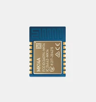
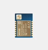
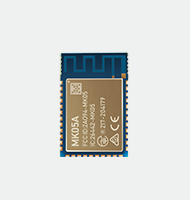
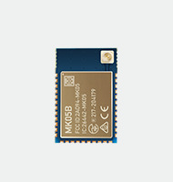
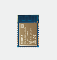
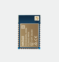
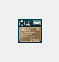
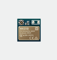
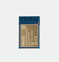
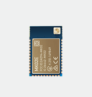
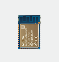
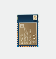
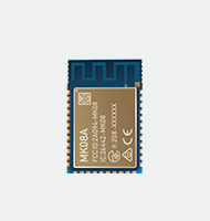
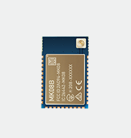
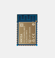
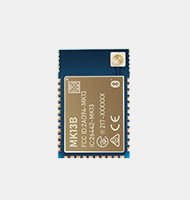
Bluetooth RTLS solutions use Bluetooth Low Energy (BLE) tags known as beacons to transmit signals to the surrounding area regularly. Later, the broadcasted signals are picked up by a device with Bluetooth capabilities, such as BLE tags and Beacons, Bluetooth receivers, or other smart devices.
A Bluetooth Low Energy RTLS perfectly works well when set up with either Bluetooth receivers or BLE tags mounted in static locations and allocated actual coordinates. For instance, a transponder always communicates its exact location to the receiver at any time once a BLE transponder goes into the receiver’s zone. When using a Wi-Fi signal, the response is sent to a BLE Gateway which later records that data and directs it to the host computer or cloud database.
Applications of Bluetooth RTLS
In Manufacturing
- Large-scale asset tracking
- Precision tracking
- Proximity marketing
- Assembly Line Logistics
- Monitoring the movement of workers and machines
In Healthcare
- Tracking patients and medical records
- Tracking medical equipment
- Personal property tags
- Generating and collecting data
- Providing security and allocation of staffs
In-Office settings
- Wayfinding
- Tracking employees
- Generating data
- Smart mustering
- Provides proactive alerts
- Used in smartcards and badges
Zone RTLS
Zone Bluetooth RTLS is an ideal interchange between performance and cost for estimating people and assets’ real-time existence and location in the operating environs. Fixed BLE receivers minimize the effects of multipath as they use smart antennas. This creates room for a more steady RSSI (Received Signal Strength Indicator) computation.
A locating engine, based on trilateration algorithms, offers a consistent BLE tag location estimate with an accuracy of a few meters. This Bluetooth RTLS method enables commands sending to the tags for alarm triggering. For crowd monitoring of real-time, Zone RTLS is compatible with other contact-tracking devices.
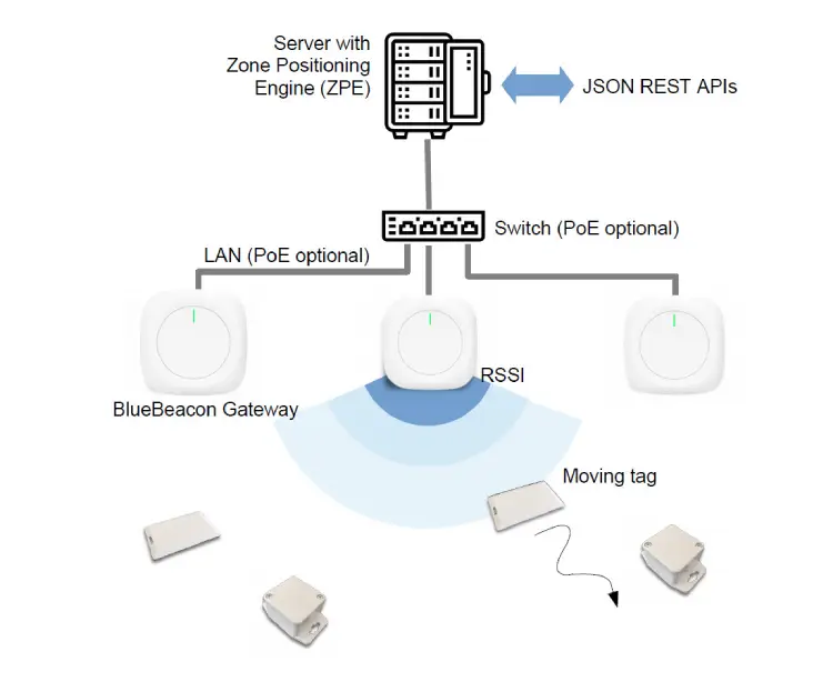
1.The architecture of Zone Bluetooth RTLS
Fixed anchors based on Blue-Beacon Gateways are mounted at recognized locations inside the setting that require localization. For indoor systems, antennas are fixed on the walls or the ceiling, and poles for outdoor systems. The antenna’s density varies greatly depending on the accuracy required in a specific zone. A rule-of-thumb is to apply the inter-antenna distance, which is usually 3-to-5 times the accuracy needed.
The BLE tags send the signal to every antenna and compute the RSSI. Using a LAN/WLAN, the antennas are linked over to a local server and install the Zone Positioning Engine (ZPE). The ZPE incorporates trilateration-based advanced algorithms, which enable the computation of tag location from every antenna’s RSSI data.
Also, the ZPE provides error estimation. Hence, the tag position is essentially a circular centered zone on the estimated location. ZPE, on the other hand, provides REST APIs in the format of standard JSON, permitting the allocation of real-time positioning of the tag(s).
2.Features of Zone Bluetooth RTLS
- Exceptional location accuracy of about 3m – The accuracy demands vary from one region to the other. It is usually controlled by increasing the number of antennas. The accuracy ranges from 1/3 to 1/4 of the antenna’s inter-distance.
- Has a position update speed of more than 1 Hz and latency down of up to one second – The rates of latency and update rate are superb in all applications requiring position-time information, such as assets tracking, room presence, and access control.
- Easy to incorporate into present pull APIs systems that provide a standard JSON/REST format.
- Zone Bluetooth RTLS has anchors that are wired – All these wired anchors are available in quite a few preferences, including a 5Vdc for power, a LAN/WLAN for information communication, and a PoE LAN for both information communication and power.
- The Zone RTLS tags have a long battery lifetime – BLE tags consume less power as they are optimized forlow energy consumption.
AccuRTLS
The performance of AccuRTLS on accuracy and precision is often unsurpassed. AccuRTLS applies Quuppa Intelligent Locating System, a super influential patented technological platform of AoA (Angle-of-Arrival). It offers real-time tracking services with sub-meter precision.
AccuRTLS offers numerous benefits:
- A longbattery life of the BLE tag
- Offers data positioning
- Easily compatible with mobile devices
- Transmits sensor data
- Offers correct real-time position updates even for the fast-moving objects
- AccuRTLS has a robust and reliable positioning performance
AccuRTLS is ideal for puzzling industrial applications like avoiding vehicle collision or accurate localization and real-time tracking of assets and people.
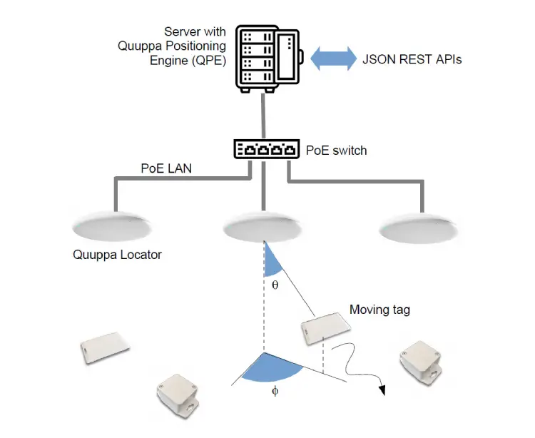
1. Architecture of AccuRTLS
Quuppa Locators antennas, also known as fixed anchors, are mounted on exact locations that require localization. In outdoor settings, weatherproof antennas are fixed on a pole, whereas the antennas are mounted on the ceiling in indoor locations. The antenna’s density varies depending on the required accuracy and the height of the ceiling.
All antennas can compute the incident signal’s direction of arrival from any BLE tag located in the area. It computes both the angle of elevation and azimuth. A local PoE LAN with PoE switches connects the Quuppa locators to a local server and later installs the Quuppa Positioning Engine (QPE). The QPE incorporates triangulation-based advanced algorithms that compute tag positions from every antenna’s angle-of-arrival data. QPE offers REST APIs in the format of standard JSON, allowing real-time access to the tag(s) position.
2. Features of AccuRTLS
- AccuRTLS has a precise location accuracy of around 0.5 meters – The accuracy demand varies from one region to another. It is controlled by increasing the density of the antennas.
- Its latency down rate is up to 100 m/s and a location update speed of up to 50 Hz – All this, coupled with its superb accuracy, enables the application of numerous safety-related use cases, for instance, avoiding collisions amongst people and vehicles in industrial settings.
- Bluetooth RTLS AccuRTLS is easy to integrate into a pull or push APIs present systems that provide a CSV or standard JSON/REST format. The API is entirely configurable andopen.
- Has wired anchors – Its Quuppa Locators antennas apply the PoE LAN for both data communication and power.
- AccuRTLS have long battery-lifetime tags – BLE tags consume less power as they are optimized for low energy consumption.
MeshIPS for Bluetooth RTLS
1. Types of mesh topology
There are two types of mesh topology. They include; full mesh and partial mesh.
a.Full mesh
Full mesh follows once each node has a path linking it to all other nodes in the network. Full mesh offers the highest redundancy, so it directs its network traffic to other nodes if one of its nodes flops. This topology is typically set aside for support networks.
b.Partial mesh
With partial mesh, certain nodes are prearranged in a full-mesh structure, while the others are only linked to one or two nodes in the network. The partial mesh technology is normally found in peripheral networks that are linked to full meshed support.
The partial mesh topology yields more redundancy than full mesh, although implementing it is less costly.
2. What is Wirepas Mesh?
Wirepas Mesh is a cable-less IoT solution and has a meshed network structural design. Every device in the Wirepas Mesh network can locally make routing decisions centered on the current radio situations. The de-integrated Wirepas Mesh architecture delivers a consistent and easily accessible high data transmission rate and has a large coverage position.
The intelligence of Wirepas is de-centralized onto the devices and in the mesh network. Wirepas devices independently make routing decisions based on the existing radio energy and spectrum. The Wirepas Mesh does not need a central network hub device.
A Wirepas device can transfer information across several hops from one node to the other and the cloud and back. Numerous routing options exist in every device, where Bluetooth IoT devices can use the same network.
3. What is MeshIPS?
MeshIPS offers cost-effective and accessible solutions when linking and localizing sensors and tags using the Wirepas Massive, commonly known as Wirepass Mesh. Its exceptional low-power mesh setup enables the creation of fully battery-operated networks that have a battery life of several years.
This solution provides a location system that is easy to install and efficiently accessible for numerous use cases in hospitals, warehouses, tunnels, and building sites. It consists of a wireless infrastructure that tracks assets without any cabling cost or intricate planning.
MeshIPS offers a classic room/zone accuracy performance, excellent battery lifetime, and a distinctive interval location of minute(s). It currently has the least ownership cost and infrastructure in the market.
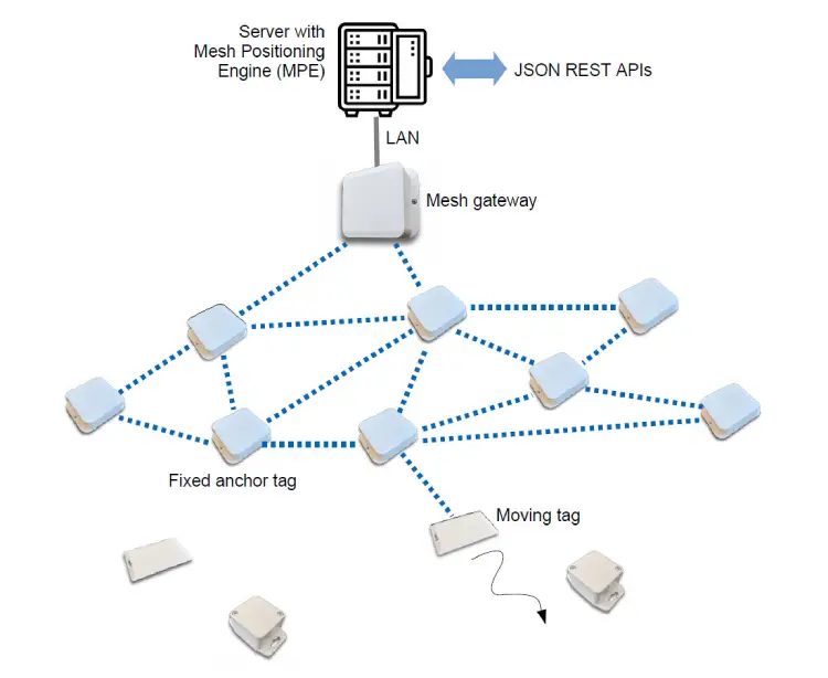
4. Architecture of MeshIPS
The infrastructure positioning and communication of Mesh IPS is fully based on the Wirepas mesh network. This indicates that no extra communication setup such as WLAN or LAN is required.
The tag’s power of a signal is forwarded and computed by the nearby antennas to the mesh gateway via the mesh network. Mostly, more than one mesh gateway is needed, but this depends on the network’s size.
Mesh gateway is straightforwardly linked to a local server and installs the positioning engine. The engine incorporates trilateration-based algorithms allowing the computation of the tag’s position from the RSSI data received from every anchor. It offers REST APIs in the format of standard JSON, enabling the tags to acquire real-time positioning.
5. Features of MeshIPS
- Precise location accuracy of around 5 meters – The number of anchor nodes determines the accuracy, mostly ranging from 1/3 to 1/2 of the antenna’s inter-distance.
- Its update rate of location is less (more than 3 minutes) – Typical MeshIPS applications do not require real-time positioning. When specific events such as accelerometer trigger or button pressure exist, its interval positioning can be cut to 15 seconds.
- MeshIPS is easy to fix intopull APIs current systems that provide a standard JSON/REST format.
- Have battery-powered antennas- Its fully cable-less infrastructure minimizes the costs of maintenance and installation.
- MeshIPS tags are battery-powered – Its working life can be increased to several years by increasing the position update interval.
Difference between Bluetooth mesh and MeshIPS
Bluetooth mesh uses Bluetooth to allow multiple device communications and is improved to create comprehensive device networks. It is fit for automation and control monitoring solutions that need multiple devices to connect. Bluetooth mesh is accustomed to core specification version 4.0 and higher as it only supports upgradable products. Some factors like the Bluetooth chip memory determines the upgradeability of the device.
On the other hand, a MeshIPS uses Wirepas Massive to link and localize tags and sensors. Its exceptional low-power mesh setup creates a fully battery-operated network. The MeshIPS is easy to install and an essential location system for multiple applications as it consists of a wireless structure for ideal tracking. It provides a great room and zone accuracy performance with a specific position interval of minute(s). The MeshIPS offers the lowest setup, and it is the cheapest in the market.
Comparing Zone RTLS, AccuRTLS and MeshIPS
| Zone RTLS | AccuRTLS | MeshIPS |
| Zone RTLS use smart antennas for real-time tracking | AccuRTLS uses the Quuppa Intelligent Locating System for real-time tracking | MeshIPS uses Wirepas Massive for real-time tracking |
| It communicates through fixed anchors based on Beacon Gateways | It communicates through Quuppa Locators antennas installed at precise locations | It communicates through the Wirepas mesh network |
| Its antennas are linked through LAN/WLAN to a local server that installs the Zone Positioning Engine (ZPE) | Its Quuppa locators are linked, through a local PoE LAN to a local server that installs the Quuppa Positioning Engine | Its mesh gateway is directly connected to a local server that installs the Positioning Engine |
| Its positioning accuracy is around 3m | Its positioning accuracy is around 0.5m | Its positioning accuracy is around 5m |
| Its latency is down to 1 s and has a location update rate of up to 1 Hz | Its latency is down to 100ms and has a location update rate of up to 50 Hz | Has a location update rate of a less than 3 minutes |
| ZoneRTLS is easy to incorporate into present pull APIs systems that provide a standard JSON/REST format | AccuRTLS is easy to integrate into a pull or push APIs present systems that provide a CSV or standard JSON/REST format. Its API is entirely configurable and open. | MeshIPS is easy to fix into pull APIs current systems that provide a standard JSON/REST format |
| Its anchors are wired | Its anchors are wired | Its anchors are battery-powered that are completely cable-less |
| Its BLE tags consume less power as they are optimized for low energy consumption | Its BLE tags consume less power as they are optimized for low energy consumption | Its battery life can be increased to several years by increasing the position update interval |
How to choose the best Bluetooth RTLS technology
There are several options available to choose for your RTLS solution. They all answer back to the certain requirements of the different Bluetooth RTLS applications and the various ecological aspects that have to be considered. Furthermore, there are more variables with a strong influence on the kind of RTLS option required for a certain deployment and level of accuracy.
Although most individuals think that a super-hyper-mega-accuracy is always the right way to go, with an RTLS, that is not always the case. When deciding on the best Bluetooth RTLS for most use cases, considering zonal accuracy is more than enough. It is better to consider XY positioning in other circumstances, although it comes with a price tag. Before you decide on the RTLS option to deploy, it is important to understand which option best applies to your business requirements.
AoA RTLS
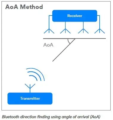
The signal’s angle of arrival (AoA) is the direction received from a signal. It is measured by knowing the broadcast direction of an antennae’s incident in a radio-frequency wave or by determining the maximum signal strength used during the rotation of an antenna.
The AoA in the RTLS solution is computed by assessing the time difference of arrival (TDOA) between different sections of the array. This TDOA measurement is achieved by calculating the received phase difference at every section in the antenna array. It is thought of as reverse beamforming.
In beamforming, the signal from every section is evaluated to direct the improvements of the antenna array. In AoA RTLS, the arrival delay at each section is directly assessed and changed to an AoA measurement.
1. How the AoA works
A sending device integrated with the AoA direction-finding support feature, for instance, a tag in an Bluetooth RTLS solution, uses a single antenna to transfer a special direction-finding signal. On the other hand, a locator, the receiving device in the same RTLS, has some anchors lined up in an array.
The receiving device constantly experiences a difference in the signal phase when a transferred signal crosses the array. This is due to the distance difference between the transmitting antenna and the antenna in its array. The receiving device switches in between the array’s active antennas after taking the signal’s IQ samples. The receiving device calculates the relative signal direction using the IQ sample information.
2. All solutions of AoA
The AoA direction-finding method is mostly used in RTLS solutions and proximity solutions, like the point of interest information services and item finding.
a. RTLS solutions
When AoA is implemented, all RTLS solutions deployed in the right settings can improve the position accuracy to centimeter-level. An RTLS with the Angle of Arrival makes location tracking easy with greater precision. It also alerts employees in an organization when they are in unsafe work environs.
b. IPS solutions
All IPS solutions with the Angle of Arrival require fewer locator beacons to attain a greater accuracy, generating more effectiveness to deployments.
c. Item finding solutions
Most users experience a big bump on the item finding solutions. When a phone is integrated with the AoA direction-finding support feature, it enables the item finding solutions to leverage directional data. With this, the user easily identifies the position and direction of a misplaced item.
d. Point of interest (PoI) information solutions
An AoA with direction-finding, when added to a phone, is beneficial to PoI information solutions. At present, a PoI information application installed in a phone can notify the user of different products in an exhibition room and enables them to receive extra information when they select one product. An AoA with a direction-finding support feature enables users to easily access a product and acquire more information regarding that item using their smartphones.
3. Limitations of AoA
The jitter Analogue to Digital Converter and Digital to Analogue Converter accompanies the accuracy limitations on estimating the angle of arrival signals in digital antenna arrays. A faulty device can easily change the accuracy of the calculated AoA information by interfering with the packet structure. This is because devices with a Bluetooth version less than 5.0 do not impose any security requirements.
The exact accuracy can only be achieved by changing the receiver as it imposes an improvement to the device standard. Instead of applying one core antenna and swapping to the other only for assessing the phase delay, keep the other antenna active to receive the next packet.
4. Comparing AoA RTLS and AoD RTLS
a. The angle of Arrival (AOA)
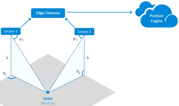
In the Angle of Arrival (AoA), assets transmit their position to a locator like the light connected, cable-less access point or the smart luminaire. These locators measure the arrival angle of the signal.
When considering the design, assets in an AoA can be of low power and only requires a single antenna. They also simultaneously support the functionality of extra Bluetooth Low Energy.
The antenna arrays and switches of the AoA locator’s design are either 3 x 3 or 4 x 4. Moreover, the process angle readings of the edge gateways determine the device’s position after communicating with the cloud’s asset management system.
b. The angle of Departure (AoD)
In the Angle of Departure (AoD), information is conveyed by beacons that use several antennas. Here, mobile devices collect the beacons and estimate the location of the intended item.
The antenna arrays and switches in beacons of the Angle of Departure require a 3 x 3 or 4 x 4 design. Mobile devices must be available for supporting AoD algorithms. The location services system determines the coordinates of the beacon.
Other radio technologies ideal for zonal accuracy and room-level accuracy
Other than Bluetooth, other radio technologies can realize zonal accuracy and room-level accuracy. The exact cost of a radio RTLS depends on the deployment aspects that are essential in its application.
| RTLS Type | Accuracy | Battery Life |
| Bluetooth Low Energy | 4 meters | 15 to 20 months |
| Wi-Fi | 3 meters | 3 to 4 years |
| Active RFID | 5 meters | 3 to 10 years |
Bluetooth Low Energy is the most commons radio RTLS system supported by multiple Wi-Fi access point vendors. Hence, it is possible to run a BLE RTLS using a Wi-Fi network, with no need to install an extra gateway.
Both Wi-Fi and Active RFID technologies give signals using tags to those devices that identify the signals after every few seconds. When determining the exact position of the tags, these signals must be analyzed carefully. These two systems are ideal for Zonal Tracking and room-level accuracy as they can both operate at room level. Nevertheless, passive RFID tags are cheaper than active RFID tags.
Although most Bluetooth beacon use Zone RTLS and Accu RTLS, you can also apply other radio RTLS technologies to your beacon devices. Some of these technologies you can integrate to implement the hybrid RTLS are;
- Wi-Fi RTLS – This technology applies tags that convey a Wi-Fi signal to various access points in the surrounding areas. With WIFI RTLS, the receivers can locate tags using differential-time-of-arrival methods.
- Ultra Wide-Band (UWB) RTLS – The Ultra wide-band RTLS offers the best location precision. Its signal is conveyed via low-powered tags that use a transmitter.
- Active RTLS – Uses battery-powered sensors to transfer information to the cloud, and it links with diverse access points.
As Bluetooth Low Energy (BLE) is an essential building block for IoT solutions, MOKOBlue supports various BLE devices and beacons projects. We offer state-of-art RTLS solutions tailored for your needs for tracking, identification, locating, and sensing applications. MOKOBlue also assists you in answering any additional questions about Bluetooth devices using the bluetooth RTLS technology and how asset tracking can work best for your projects.
